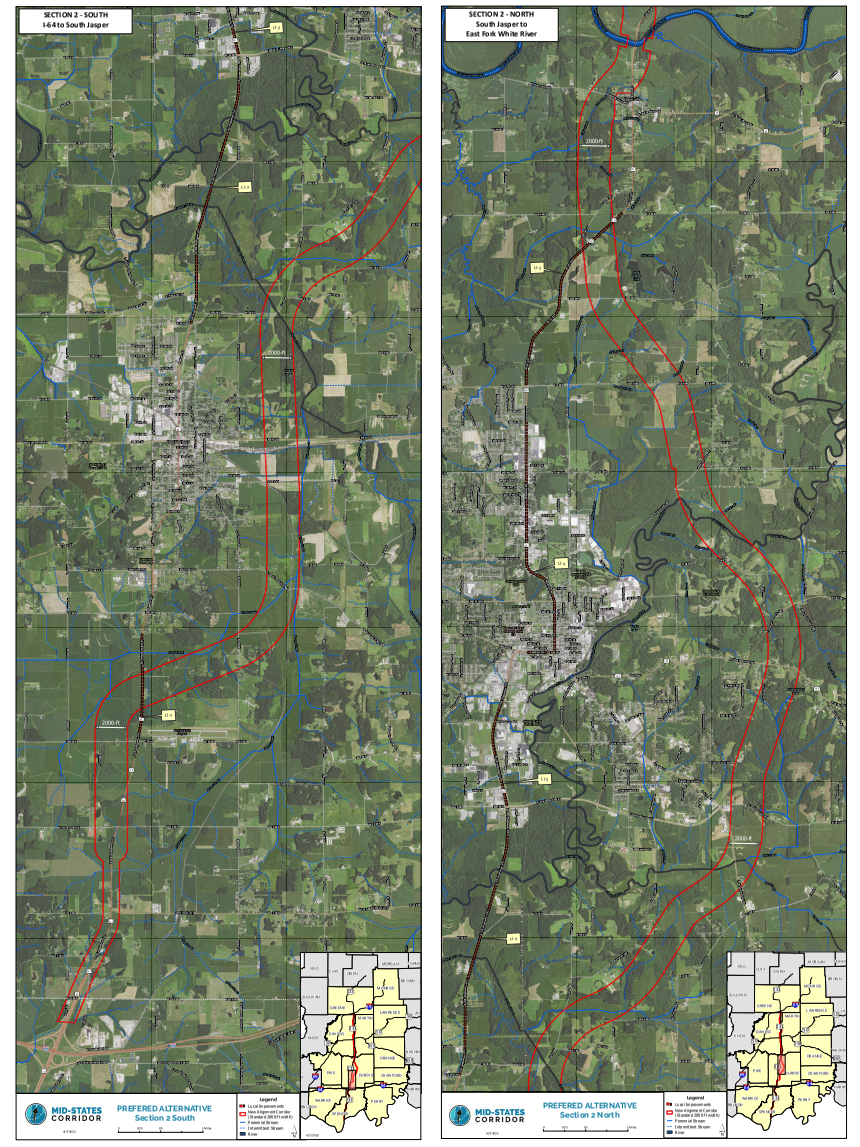
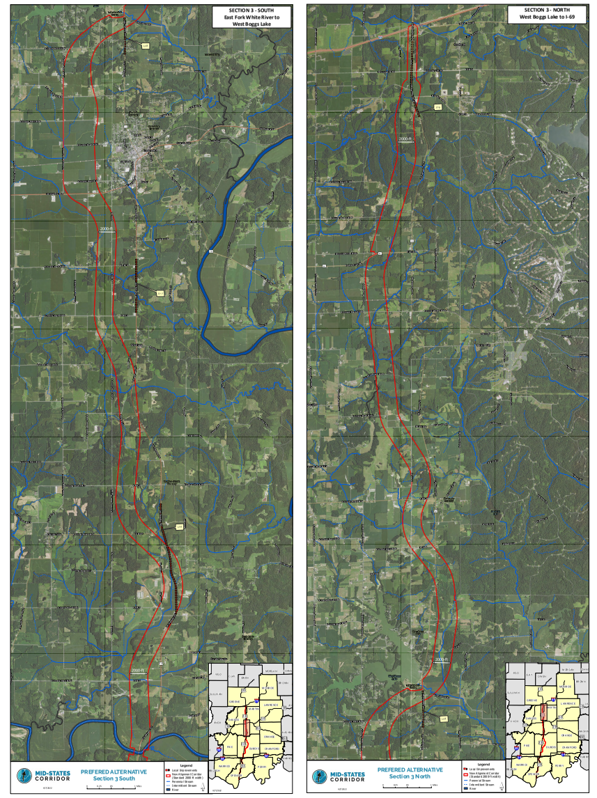
Project Maps
Tips for Viewing Maps
Click the link below each map to download a high-resolution version for more detailed viewing.
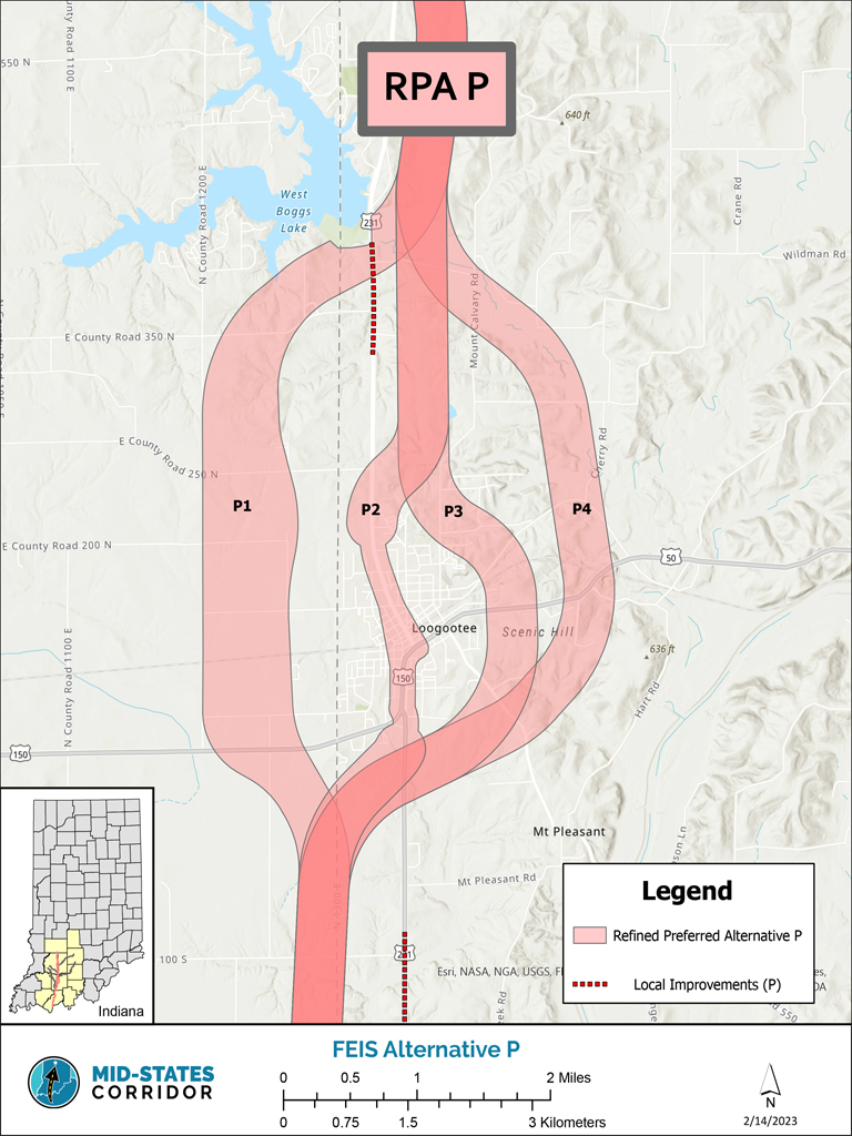
Click the link for a high-resolution map for detailed viewing of the corridor routes (large file not for print).


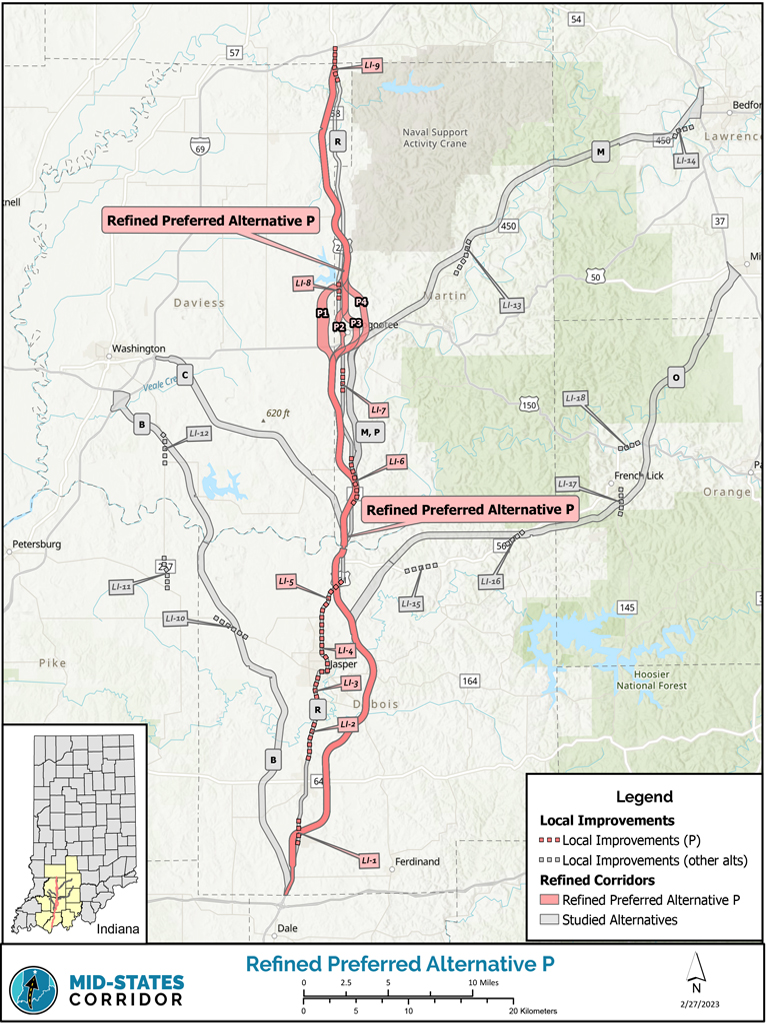
Click the link below each map to download a high-resolution version for more detailed viewing.
Click the link for a high-resolution map for detailed viewing of the corridor routes (large file not for print).