ABOUT
Mid-States Corridor Tier 1 Environmental Study
Tiered Environmental Study
Regulations allow NEPA studies for large, complex projects to be carried out in a two-staged, “tiered” process. In the first tier, “big picture” issues are addressed, while taking into account the full range of impacts. After the “big picture” issues are resolved in Tier 1, the focus shifts in the Tier 2 NEPA study to issues associated with a more exact determination of impacts and the avoidance and mitigation of adverse impacts. The Tier 1 study includes fact-based analyses that will support informed decision-making on corridor-wide issues. The Tier 2 study will include more detailed analyses.
Environmental Impact Statement

Benefits

Impacts

Costs
Tier 1 NEPA Process
- Analysis of a range of reasonable alternatives
- Public involvement, including opportunities for participation and comments
- Coordination and consultation with local, state and federal agencies
- Assessment of the social, economic and environmental impacts
- Consideration of ways to avoid, minimize or mitigate impacts
- Identify refined corridor within which the final alignment will be placed
- Proceed with more detailed Tier 2 assessment to determine exact alignment
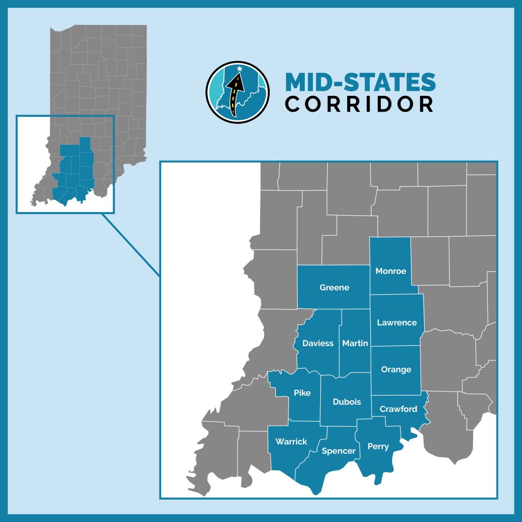
Project Study Area
The Project Study Area is the region in which project alternatives may be located. It also includes areas which may experience changes in traffic patterns from the project. The Mid-States Corridor Project Study Area generally is defined as those counties within the area bounded by I-69 on the west and north, SR 37 on the east and north and the Ohio River on the south. The Study Area consists of counties because many important economic and demographic data and forecasts are available on a county basis. The Study Area includes Spencer, Dubois, Perry, Warrick, Pike, Daviess, Crawford, Orange, Martin, Lawrence, Greene and Monroe counties.